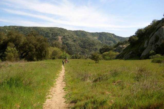
The Laurel Canyon Trail is one of our favorite hikes in Orange County because of the exciting things we have discovered there.
Seeing the waterfall of Laurel Canyon has been an enticing prospect for us and was the main reason we first hiked this trail. We were a bit disappointed, but not too surprised, to not see any water flowing over the rocks at the top because we knew there was not a good water source for the seasonal creek bed. Despite not getting to see the water in action, we did discover quiet meadows, towering oak trees, and a large rock that looks almost identical to the shimmering ghosts from Pac Man. Our kids loved climbing through the small cave holes and spying shell fossils in the creek beds. We have come back to this trail time after time and it is now one of our favorites.
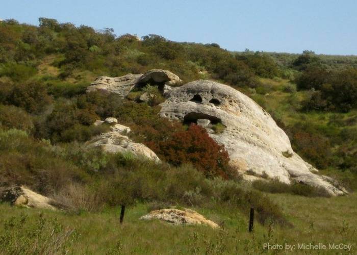
The Laurel Canyon Trail starts at the parking lot of the Willow Staging Area off of Laguna Canyon Road and climbs over some rocks with small caves just begging to be climbed through. The trail then seems to head right parallel to Highway 133/Laguna Canyon Road, but quickly takes hikers into a quiet meadow. About 1/2 mile through the meadow, Ghost Rock appears on the right side where eagles have been seen soaring out of its “eyes.” Along the trail are wooden posts with a phone number to dial and listen to a prerecording of information about that section of the trail.
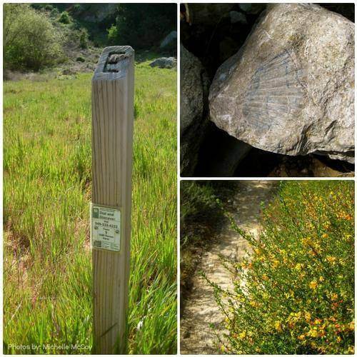
The trail climbs uphill after Ghost Rock, so that spot can be a good turn-around-spot for families with young kiddos. For those brave enough to hike another mile uphill, there are dry creek beds to cross and vistas of the valley behind. Take some time to look at the rocks in the creek beds for fossil prints of shells. The trail crosses the top of the waterfall and continues uphill for another 1/2 mile.

Hikers who pass the waterfall will continue uphill for approximately 1/2 mile further and on clear days, the ocean is visible. The trail then continues along the ridge, the Laurel Spur, and then down the steep Willow Canyon Trail to the parking lot where it all started.
Trail Details and Tips:
- Difficulty: Easy to moderately strenuous
- Distance: 1.8 miles to the waterfall one-way; 3.6 miles there and back. A 4-mile loop along Laurel Canyon, Laurel Spur, and Willow Canyon Trail is an option.
- Elevation Gain: Approx. 375 feet
- Stroller Accessibility: Difficult to use over narrow trails and rocks. Baby backpack is preferable.
- Trail starts at the Willow Staging Area. Follow the dirt road away from Laguna Canyon Road, turn right at the first trail and follow it as it travels almost directly back towards Laguna Canyon Road.
- $3 parking fee
- Ticks and poison oak have been spotted along this trail so take caution. Don’t touch any plant with “leaves of three” and check everyone’s skin after the hike for any ticks.
- Dogs are not permitted on the trails.
